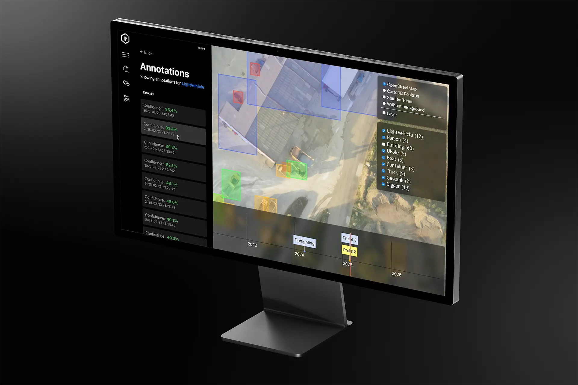
LPP’s Autonomous Drone 3D Mapping enables fast generation of detailed 3D models from 2D aerial imagery captured by autonomous UAVs. The system includes a lightweight application accessible via phone, tablet, or computer, allowing users to process and view mapped areas within minutes.
Users can inspect the 3D environment and mark key points of interest directly in the interface. An integrated AI model detects and labels features such as buildings, vehicles, and terrain elements, while also tracking changes across multiple flights. This timeline functionality is especially valuable for monitoring dynamic environments, such as wildfire spread or movement within a secured zone, providing insights for time-sensitive decisions.
LPP also developed Visual Navigation technology to support UAV operations in GPS-denied environments.