Inertial navigation for manned and unmanned aircrafts
Attitude and Heading Reference System AHRS
- Determines aircraft position, orientation, and velocity with multi-system GNSS support.
- Operates as an inertial unit for navigation in GPS-denied environments for manned and unmanned aircraft.
- Built for medium to large drones, it also integrates as a standard component in the ESIS unit.
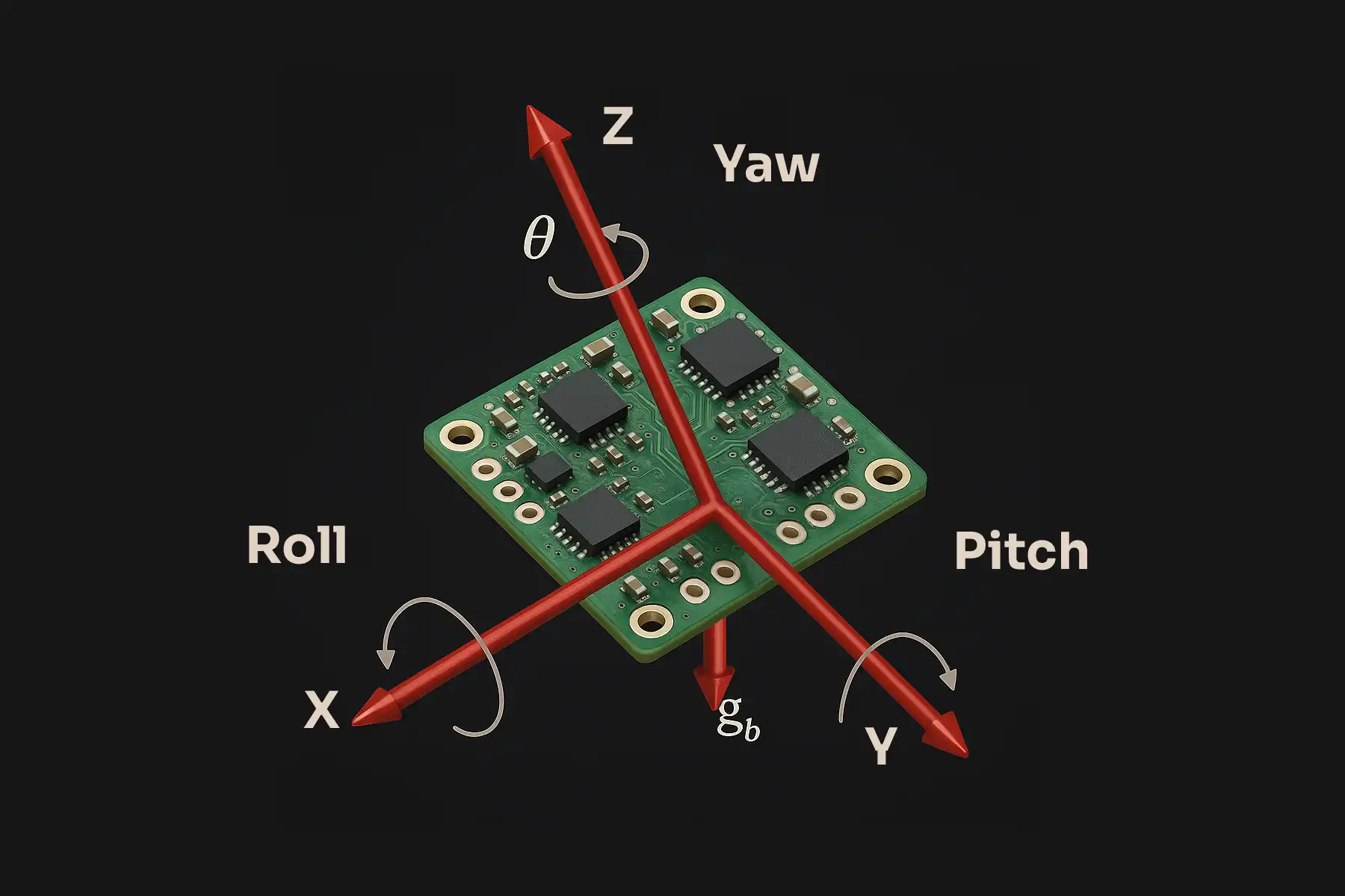
- Uses Kalman filtering to process gyro, distance, pitch, and roll data for accurate navigation.
- Measures acceleration and angular velocity along three axes for real-time position updates.
Basic description
The Attitude and Heading Reference System (AHRS) determines position, orientation, and velocity in GPS-denied environments. It provides redundancy for both manned and unmanned platforms. AHRS operates as a stand-alone inertial unit for medium to large drones. Alternatively, it functions as an integrated component of the Electronic Standby Instrument System (ESIS), serving as an essential backup system for emergency situations.
The system processes data from gyroscopes, accelerometers, and a multi-system GNSS receiver. It utilises a 3-axis magnetometer and an air data system to continuously update position and orientation via Kalman filtering.
LPP also applies similar technology in its Inertial Navigation Unit for armoured vehicles and UGVs.
Technical description
| Attitude Rate Measuring Range | Min. ±200°/s |
| Linear Acceleration in Z Axis | -4 to +8 g |
| Gyro Bias Stability | Better than 3 deg/h, Dynamic Range 500 deg/s |
| Measuring Linear Acceleration | 40 g |
| Attitude Data Stability | Up to 0.1 deg/h |
For more details, contact us at email info@lp-praha.cz.
Headquarters
- LPP s.r.o.
- Pod Hajkem 406/1a, 180 00 Prague
- Czech Republic
Production facility
- LPP s.r.o.
- Delnicka 475, 530 03 Pardubice
- Czech Republic
Documents
Contact
Headquarters
- LPP s.r.o.
- Pod Hajkem 406/1a, 180 00 Prague
- Czech Republic
Production facility
- LPP s.r.o.
- Delnicka 475, 530 03 Pardubice
- Czech Republic